

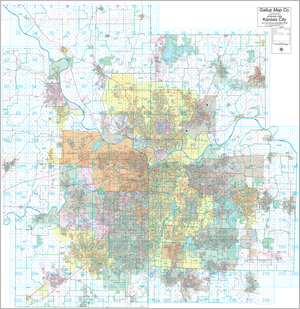
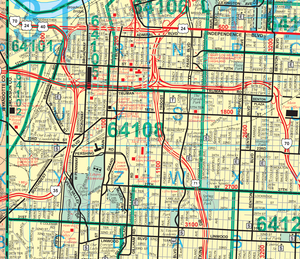
Kansas City Street and Zip Code Wall Map
$450.00 USD
2023 Complete street detail wall map with zip codes. Gallup Map has been making street maps of Kansas City since the late 1800s, and we still make our maps right here in Kansas City. It covers all of Platte,Clay,Jackson and part of Cass in Missouri and all of Johnson, Wyandotte and most of Leavenworth counties in Kansas. Available with or without zip codes and location grids. Custom maps can be made to any size and area you want, just call us for more detailed information and pricing.
Map size is 84"x84" and it comes laminated with rails for hanging.