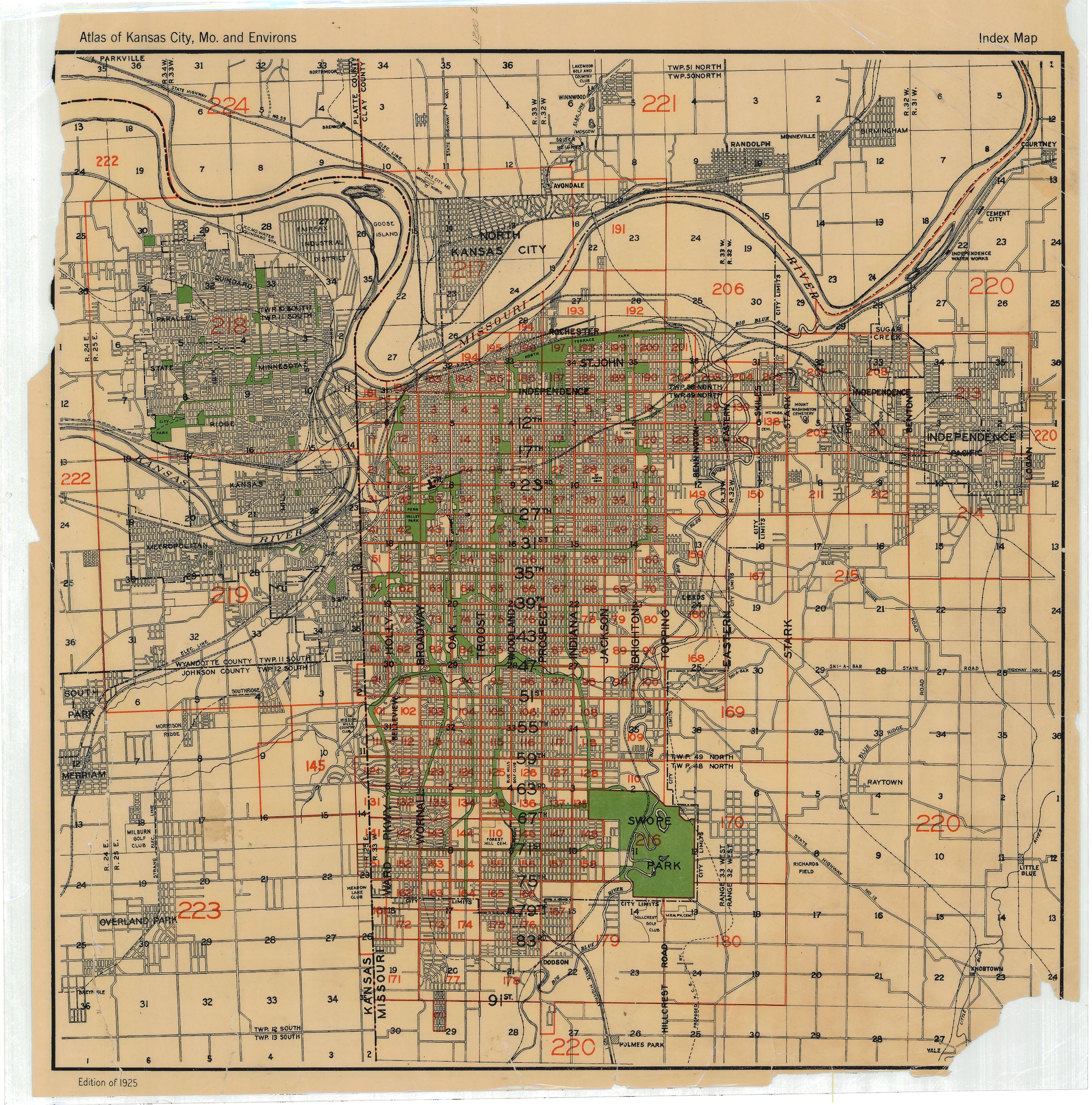
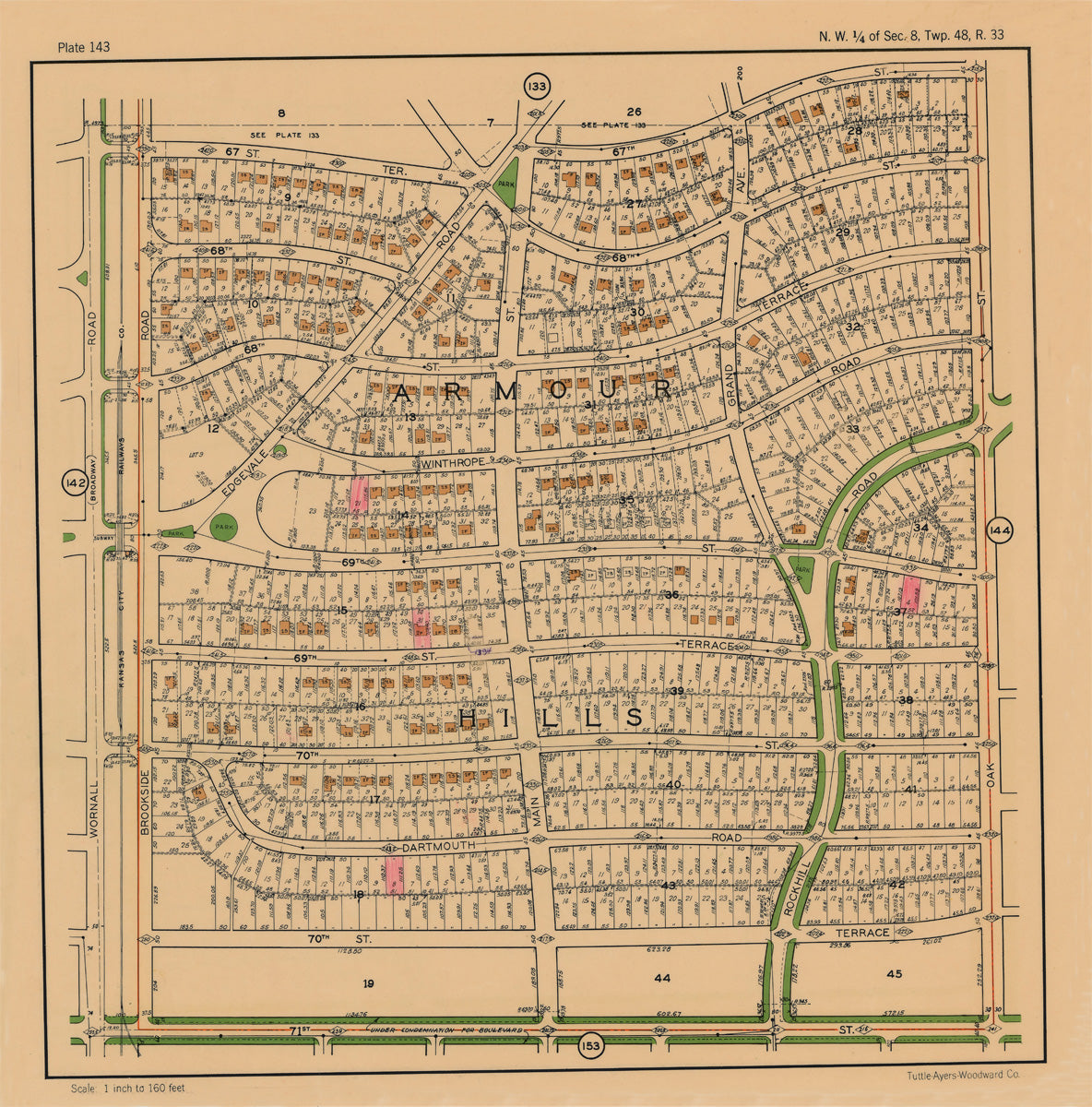
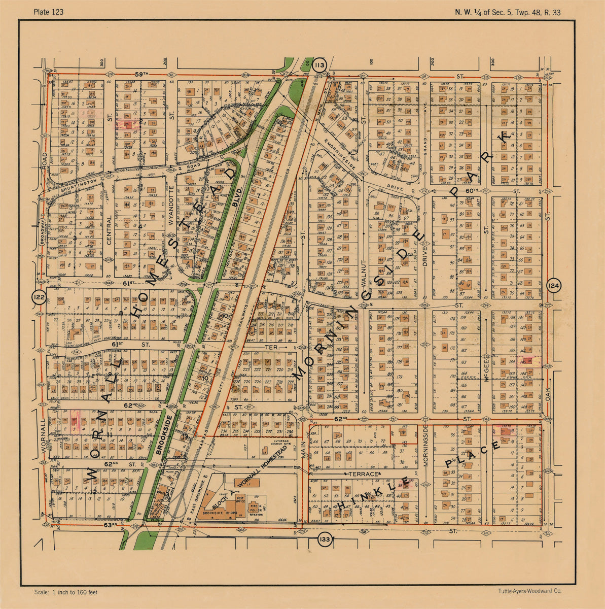
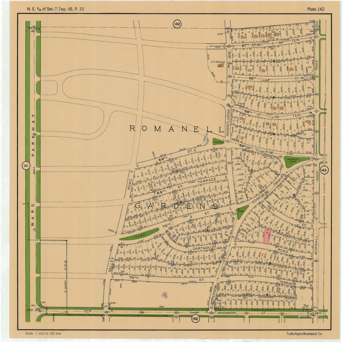
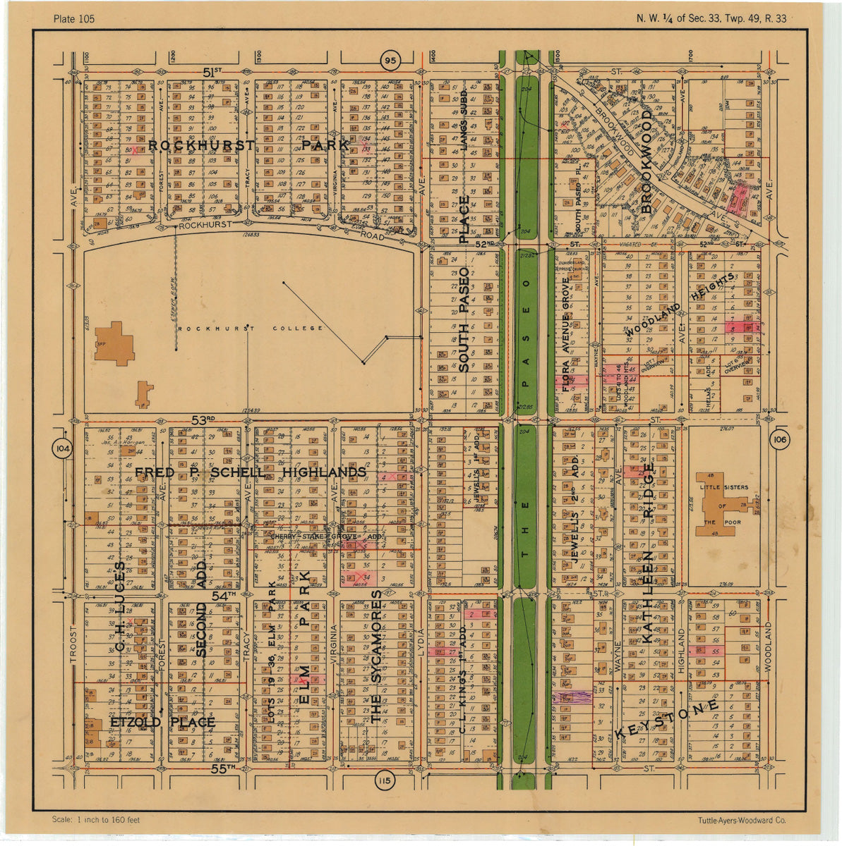
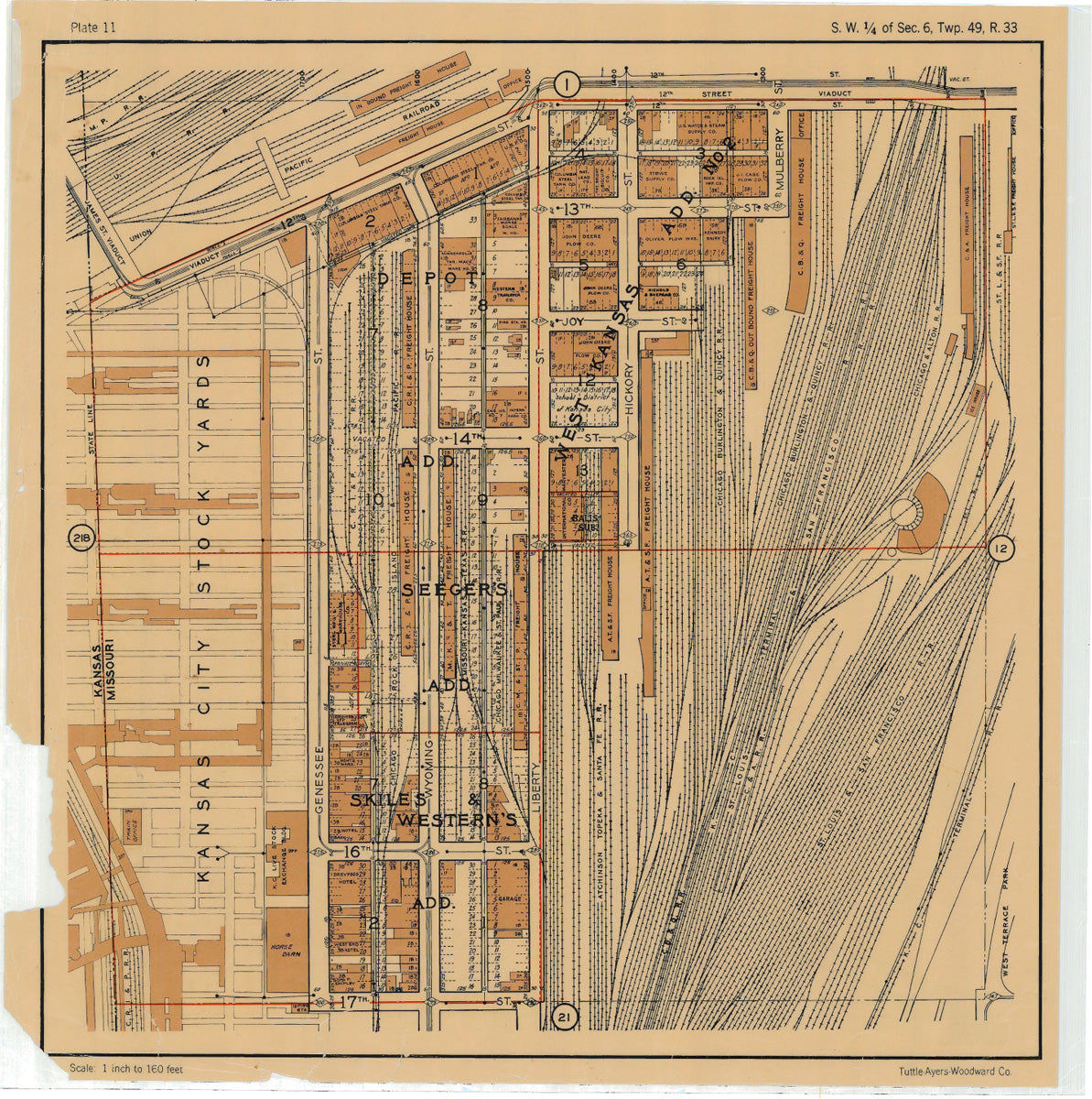
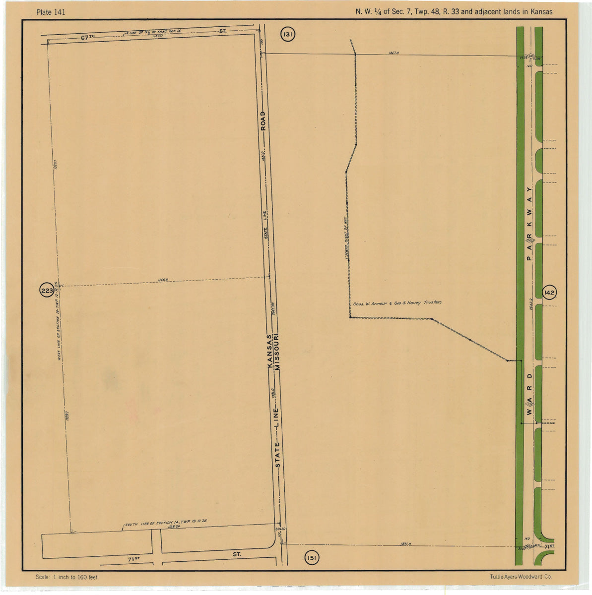
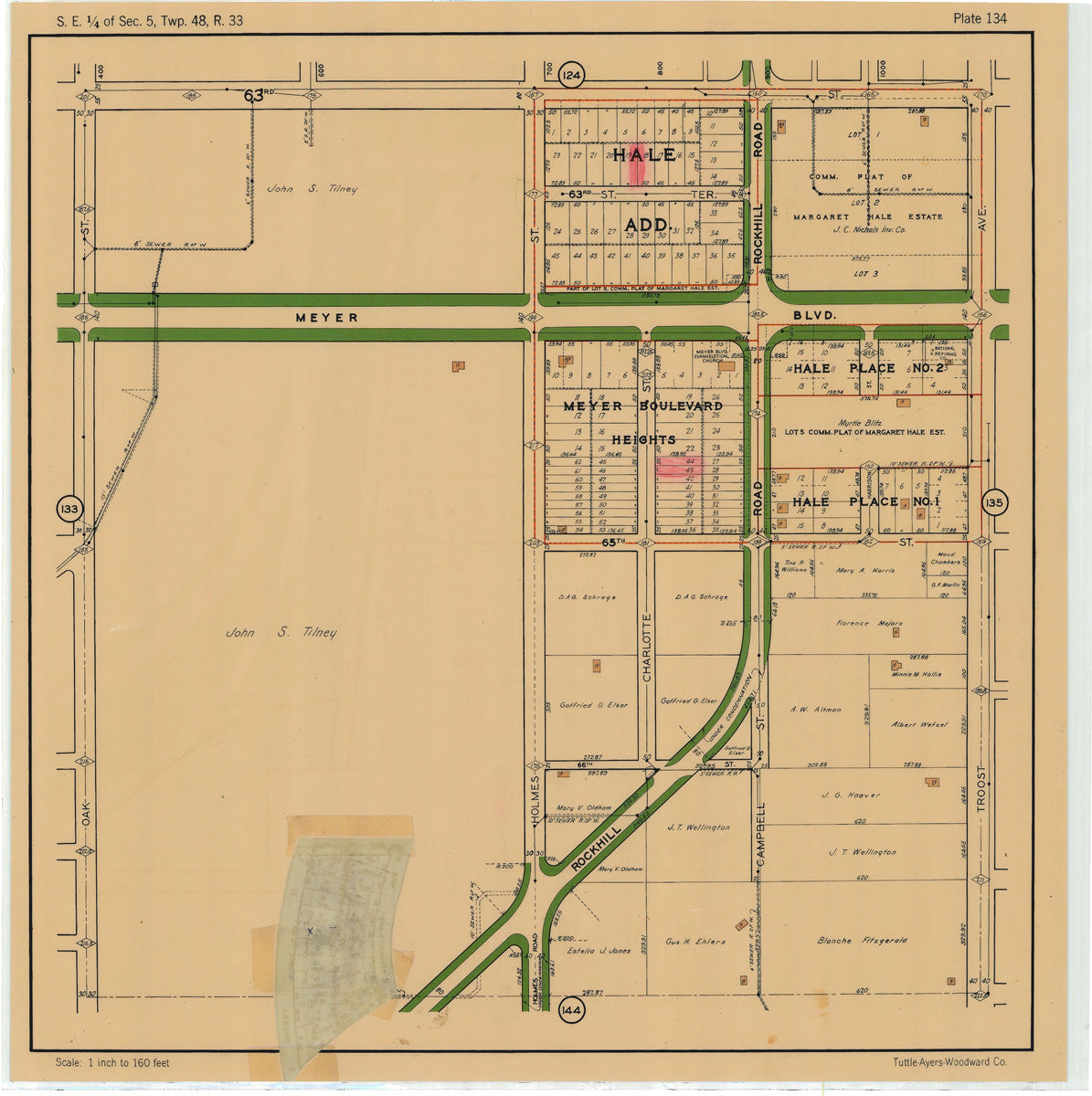
Kansas City 1925 Neighborhood Maps (Tuttle, Ayers, and Woodward)
Fantastic detailed maps showing footprints of houses and buildings, lot width and depth, lot number and more. This map series can be just one map, or a collection of adjoining maps to create a collection that features all the uniqueness of your neighborhood. The maps read and look great at 24"x24", but you can use the custom size option to make one to fit your space.
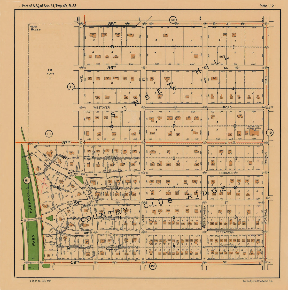
Find your neighborhood using the index map below! Right click and select "View image in a separate tab" to zoom and find your neighborhood number. Then, use the search button on the top right to search for your number!